
Excavating Beside the Dime Savings Bank
Contents
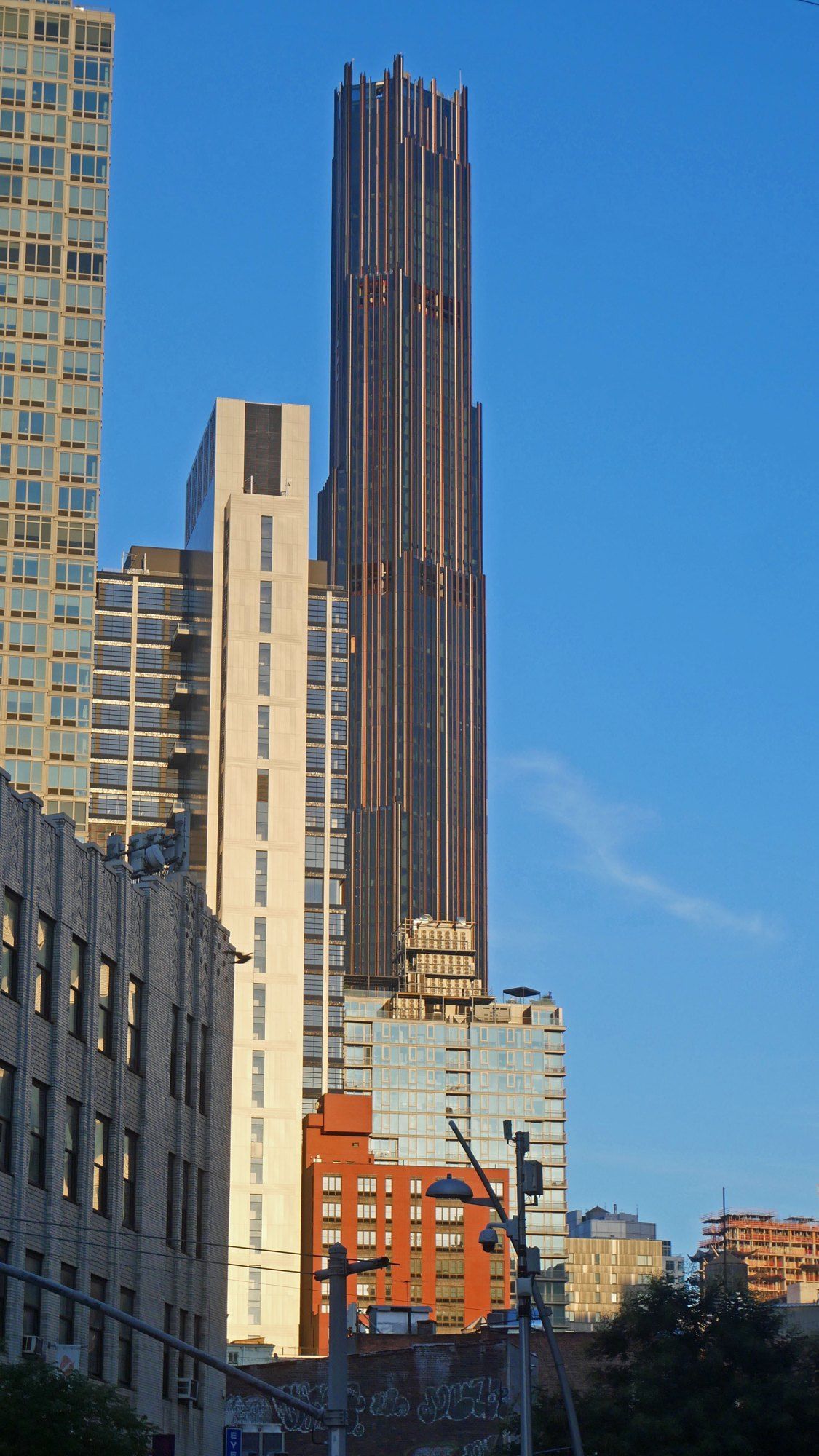
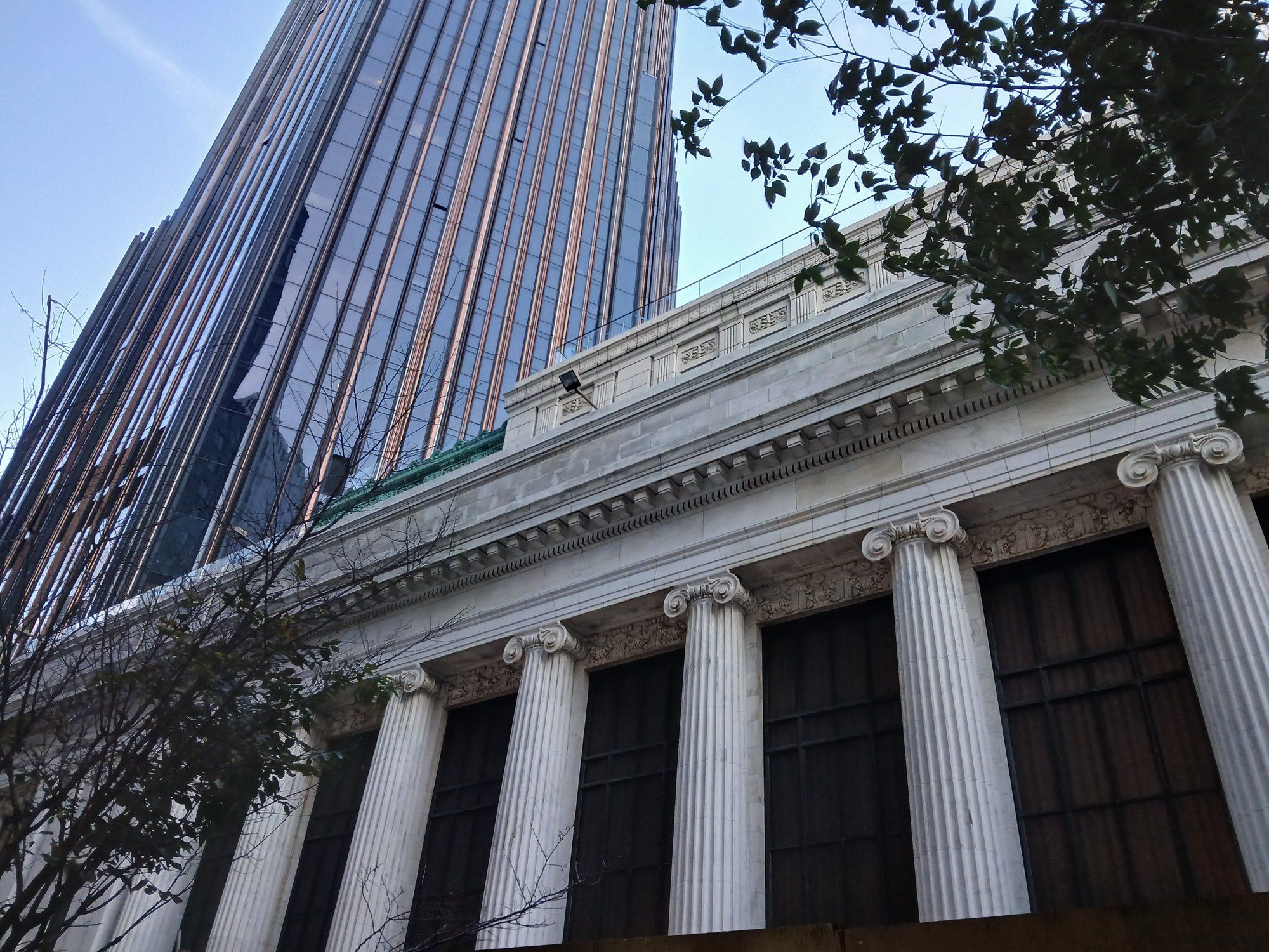
Albee Square, the plaza on DeKalb Avenue next to Michael Stern’s The Brooklyn Tower, Brooklyn’s first supertall, rising from the landmark Dime Savings Bank, makes a useful place from which to begin a walk around the ground this entry describes.1 From the square the bank’s marble front and dome are in view across the street, and the tower stands over them. Anyone digging on that block has three neighbors to reckon with: a designated bank standing since 1908, streets that have been rebuilt many times, and soil laid down by ice. The walk takes them in turn and ends back inside the bank. Along the way it passes a theater site, glacial ground hidden under the pavement, a city notice from 1988 and a shopping street that has been rebuilt more than once, each of which says something about what lies under this corner of Downtown Brooklyn.
This is an entry about the place and the general rules for a dig there; the methods that support the ground beside a deep excavation are a matter for engineers. The foundation work itself is not described in any source cited here, so it is not described.
Albee Square
The square takes its name from a theater. Cinema Treasures records that the E.F. Albee Theatre opened at 1 DeKalb Avenue on January 19, 1925, named for the vaudeville manager Edward F. Albee, with crystal chandeliers in the lobby and paintings from his collection; it soon switched to films.3 The theater closed in September 1978 and was demolished that November for the Albee Square Mall, which was itself torn down in the summer of 2008, and the City Point complex now occupies part of the site.3
The plaza has kept a civic role through those changes. At the topping out, New York YIMBY reported a steel beam set out in Albee Square Plaza for passersby to sign before it was lifted into place.2
One corner lot, four lives
- 1925the E.F. Albee Theatre opens at 1 DeKalb Avenue with a vaudeville bill
- 1978the theater closes in September and is torn down that November for the Albee Square Mall
- 2008the mall itself is demolished
- 2016a movie theater returns to the site inside City Point
The bank’s walls
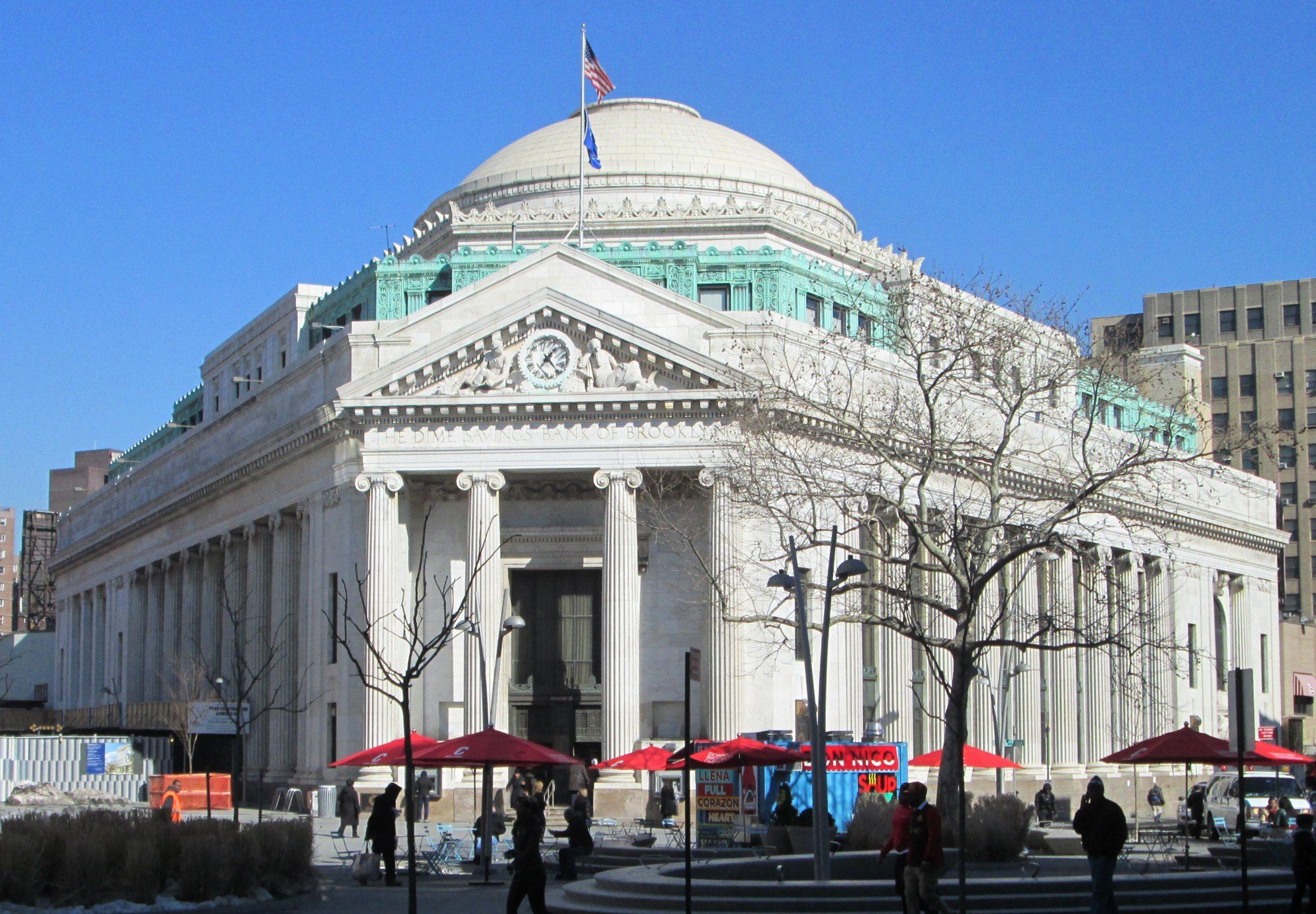
Across DeKalb Avenue stands the Dime itself. The Historic Districts Council’s designation summary describes a temple form by Mowbray and Uffinger, built in 1906 to 1908 on a lot of awkward shape and enlarged in 1931 and 1932 by Halsey, McCormack and Helmer.7 Its walls are marble, its colonnades Ionic, its dome high, and the city designated both outside and inside in 1994.7
A marble bank of this age sits on the same ground that any new neighbor must open. That shared ground is why the city has a specific procedure for construction next to historic buildings, which the walk reaches two stops from here.
Under the pavement
Below the street is glacial country. The NYC Parks history of the city’s geology explains that the Wisconsin Ice Sheet, about a thousand feet thick over New York, reached the city some 20,500 years ago, built the Harbor Hill Moraine and began to retreat about 18,000 years ago, leaving a terminal moraine of rock and debris that runs through Brooklyn and Queens.4 South of the moraine lies a broad outwash plain of sand, silt and clay, about five miles wide, beneath Flatbush, Coney Island and Canarsie.4
The ice also dropped boulders it had carried from far away. The parks department adds that large glacial erratics were unearthed in nearby Fort Greene during sewer construction, one of them several tons.4 Brooklyn College’s geology course notes draw the contrast with Manhattan: there, bedrock sits at or near the surface in most places, while in Brooklyn and Queens it is buried under a thick blanket of sediment, some of it holding boulders ten feet across.5 MiraCosta College’s regional summary adds that the highest ground in Brooklyn belongs to the Harbor Hill Moraine.9 In Brooklyn, then, a dig generally works through glacial deposits before it reaches rock, where in much of Manhattan rock lies close below the street.
The ice that made the ground
- thickness of the ice over New York City
- about 1,000 feet
- the ice reaches the city and builds the Harbor Hill Moraine
- about 20,500 years ago
- the ice begins to retreat
- about 18,000 years ago
- width of the outwash plain under Flatbush, Coney Island and Canarsie
- about five miles
The rule for neighbors of landmarks
New York wrote down how to protect a historic building from the construction next door. In June 1988 the Department of Buildings issued Technical Policy and Procedure Notice 10/88, which begins by noting that the Landmarks Preservation Commission must approve changes to protected features and that the building code already required adjacent lots and buildings to be protected and supported during foundation and earthwork.6 The notice added a monitoring program on top of that duty, meant to lower the chance of damage and to catch the first signs of it early enough to change the way the work was being done.6
The document is specific. As issued, it treated a structure as an adjacent historic structure if it was a designated landmark, sat in a historic district or on the National Register, and stood within ninety feet sideways of the lot being built on.6 It listed ground conditions that could matter, among them obstructions in fill, a shallow water table, boulders and bedrock, each paired with a risk such as vibration during excavation or loss of ground as water is drawn down.6 It then called for a licensed surveyor to monitor movement and tilt, telltales fixed over cracks already present, and observation wells to track groundwater.6 The boulders on its list are the kind of glacial erratics described at the previous stop. This entry records what the 1988 text said; the current requirements are a matter for the city and the engineers responsible for a given site.
What the 1988 notice asked a monitoring program to watch
- Scopelandmarks and listed buildings within ninety feet sideways of a lot being built on
- Surveya licensed surveyor taking optical readings at least twice a week
- Crackstelltales across existing cracks, read with a micrometer at least daily
- Waterobservation wells read at least twice a day while dewatering runs
Fulton Street at the corner
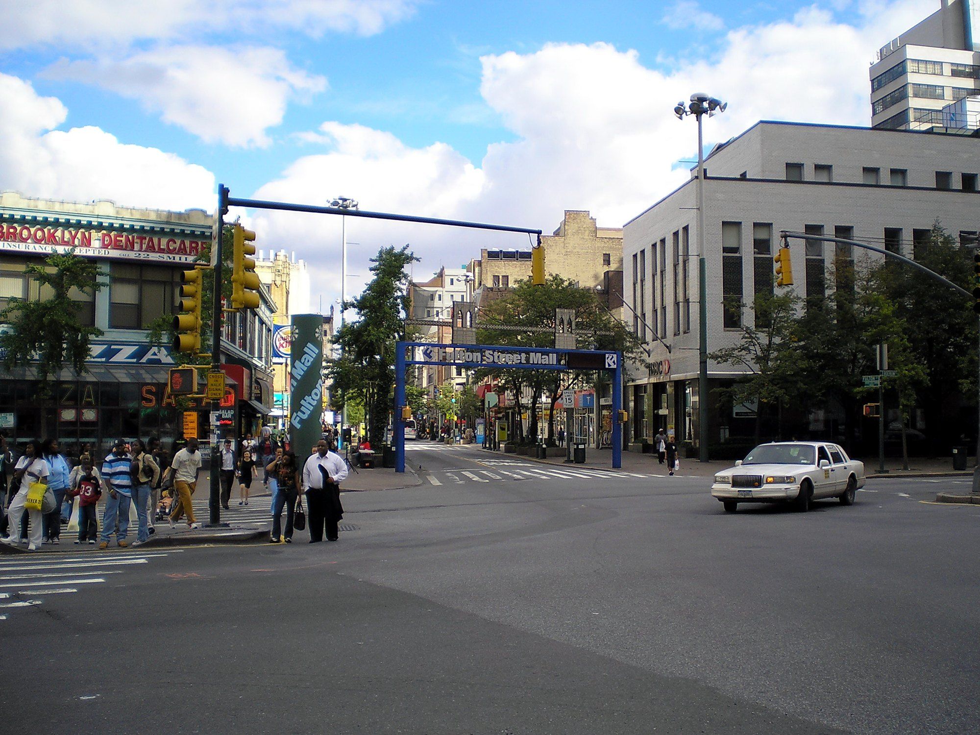
A few steps from the bank, the walk meets Fulton Street, whose history shows how often the ground here has been opened and closed. Places Journal’s review of Street Value, a study of the street, recounts how an elevated railway shadowed Fulton until its tracks came down in 1940, and how later plans turned the eight block stretch into a pedestrian mall.8 Each of those changes, from the el’s footings to the paving of the mall, left its own layer between the glacial soil and the present sidewalk.
The same review describes the Albee Square Mall, on the site of the old theater, as a center of hip hop culture in the 1980s, a scene a Biz Markie rap made famous.8 The block across from the bank has been dug, built, cleared and rebuilt within living memory.
Back inside the hall
The walk ends where the bank’s life continued through all of this. New York YIMBY’s account of the topping out gathering says it opened in the old banking hall, with colored light thrown on the columns and ceilings, and that most of the historic interior had come through intact while restoration went on.2 CBS New York reported that the bank was being worked into the design of the new building, old and new brought together.1
The ground under this block is roughly twenty thousand years old, set down by ice that has long since gone. The bank on it is a little more than a century old. The tower is the newest of the three, and it stands on the oldest.
References
- CBS New York. CBS2 Gets Inside Look At 9 DeKalb Avenue, October 29, 2021.
- New York YIMBY. YIMBY Scopes Views From SHoP's Topped Out Brooklyn Tower At 9 DeKalb Avenue In Downtown Brooklyn, October 29, 2021.
- Cinema Treasures. RKO Albee Theatre, July 19, 2019.
- NYC Parks. Hot Rocks: A Geological History Of New York City Parks, undated.
- Brooklyn College Geology. Geology Of Brooklyn And Queens, undated.
- NYC Department of Buildings. Technical Policy And Procedure Notice 10/88, June 6, 1988.
- Historic Districts Council. Dime Savings Bank, June 21, 2018.
- Places Journal. Street Cred, October 10, 2010.
- MiraCosta College Geology. Geology Of The New York City Region, November 3, 2019.
External links
See also
-
 Downtown Brooklyn and the Dime
Dime Savings Bank of Brooklyn
A savings bank of 1859, a temple of 1908, an enlargement of 1932 and a designation of 1994.
-
 Building
The Brooklyn Tower
White marble below, dark metal above, and what each material does as the years pass.
-
 Downtown Brooklyn and the Dime
Fulton Mall
Where Abraham and Straus rose, a bus and pedestrian mall followed, and the arguing never stopped.
-
 Landmarks and the City's Rulebook
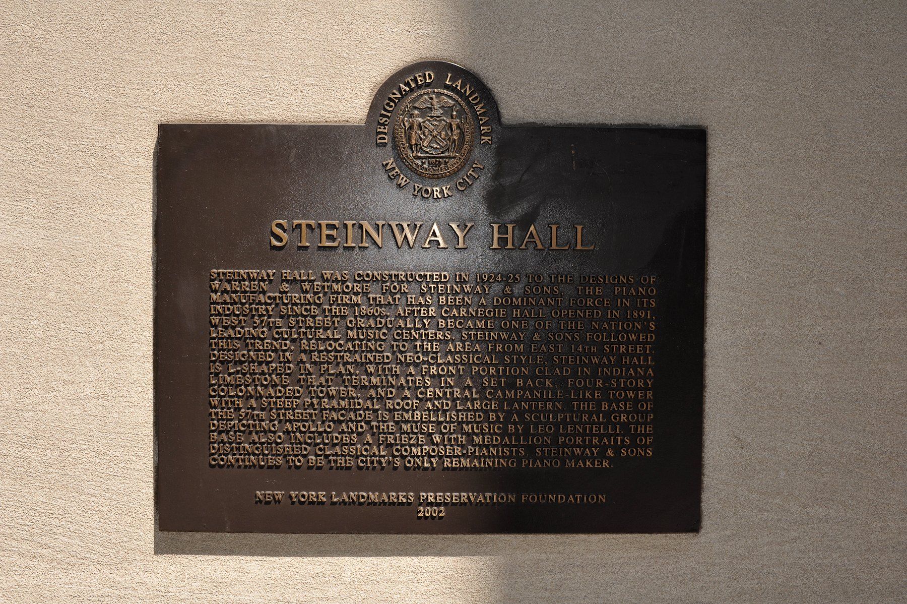
Landmarks Preservation Commission
The city agency that decides which parts of New York are kept, seen through the places it has named.
-
 Downtown Brooklyn and the Dime
The Brooklyn Tower Plan Around the Dime
Two sets of designers, one odd lot, and the six sided figure that ties them together.